
Download the app


Share this diabox
TweetInformations
- Installation date : 22/12/09
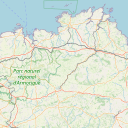
- City : Port-La-Foret
- GPS coordinates :
Latitude : 47° 53' 58.20” N
Longitude : 3° 58' 22.80” W


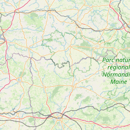

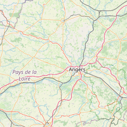

Leaflet © OpenStreetMap contributors
Live data
Date of the lastest data :
Temp / Press

Wind
Hum / Pluvio
Last hour data
| Start 2025-04-02 03:06:00 (UTC+0200) | 02/04 | 02/04 | 02/04 | 02/04 | 02/04 | 02/04 | 02/04 | 02/04 | 02/04 | 02/04 | 02/04 | 02/04 | 02/04 | 02/04 | 02/04 | 02/04 | 02/04 | 02/04 | 02/04 | 02/04 | 02/04 |
|---|---|---|---|---|---|---|---|---|---|---|---|---|---|---|---|---|---|---|---|---|---|
| 03h06m | 03h09m | 03h12m | 03h15m | 03h18m | 03h21m | 03h24m | 03h27m | 03h30m | 03h33m | 03h36m | 03h39m | 03h42m | 03h45m | 03h48m | 03h51m | 03h54m | 03h57m | 04h00m | 04h03m | 04h06m | |
| Average wind (knots) | ? | ? | ? | ? | ? | ? | ? | ? | ? | ? | ? | ? | ? | ? | ? | ? | ? | ? | ? | ? | ? |
| Gusts (knots) | ? | ? | ? | ? | ? | ? | ? | ? | ? | ? | ? | ? | ? | ? | ? | ? | ? | ? | ? | ? | ? |
| Beaufort scale (bf) | ? | ? | ? | ? | ? | ? | ? | ? | ? | ? | ? | ? | ? | ? | ? | ? | ? | ? | ? | ? | ? |
| Wind direction (°N) | ? | ? | ? | ? | ? | ? | ? | ? | ? | ? | ? | ? | ? | ? | ? | ? | ? | ? | ? | ? | ? |
| Temperature (°C) | ? | ? | ? | ? | ? | ? | ? | ? | ? | ? | ? | ? | ? | ? | ? | ? | ? | ? | ? | ? | ? |
| Pressure (hPa) | 1011 | 1011 | 1010 | 1010 | 1010 | 1010 | 1010 | 1010 | 1010 | 1010 | 1010 | 1010 | 1010 | 1010 | 1010 | 1010 | 1010 | 1010 | 1010 | 1010 | 1010 |
| Relative humidity (%) | ? | ? | ? | ? | ? | ? | ? | ? | ? | ? | ? | ? | ? | ? | ? | ? | ? | ? | ? | ? | ? |
| Rain rate (mm/h) | ? | ? | ? | ? | ? | ? | ? | ? | ? | ? | ? | ? | ? | ? | ? | ? | ? | ? | ? | ? | ? |
| Cumulative precipitation (mm) | ? | ? | ? | ? | ? | ? | ? | ? | ? | ? | ? | ? | ? | ? | ? | ? | ? | ? | ? | ? | ? |
|
|
|
|
|
|
|
|
|
|
Last 24 hours data

Please Wait
Found a problem? Contact us: 
Go to the mobile site
Experimental data. Do not use to protect goods or people.
© diabox by diateam 2009-2025 - Reproduction (even in part) prohibited.
See terms and conditions of use.
Go to the mobile site
Experimental data. Do not use to protect goods or people.
© diabox by diateam 2009-2025 - Reproduction (even in part) prohibited.
See terms and conditions of use.